

iAmaze x Lepton Software Partnership

Turn Location Into Strategy

GIS Mapping & Location Intelligence Powered by Lepton. Delivered by iAmaze

30+

Years of GIS Expertise

500+

Enterprise Clients

37+

Countries Deployed

1B+

Subscribers Served

Google Maps

Premium Partner

THE PARTNERSHIP

iAmaze × Lepton Software — Technology Meets Expertise

Lepton Software — Technology Provider

India's leading geospatial intelligence company with 30+ years of GIS expertise. Google Maps Premium Partner. Developer of NetworkAccess, SmartMarket, neo360, rfMAP, and Lepton Maps API. Trusted by 500+ enterprise clients across telecom, retail, logistics, BFSI, and government in 37+ countries.

Combined Value: Platform + Expertise

Lepton's solutions are sophisticated, data-rich platforms that deliver maximum ROI when correctly implemented and aligned with business workflows. iAmaze's domain expertise ensures every deployment is configured, integrated, and optimised for your specific industry context and strategic goals.

iAmaze — Implementation & Consulting Partner

Authorised Lepton Software partner providing turnkey implementation, system integration, training, and ongoing managed support. iAmaze bridges the gap between Lepton's powerful technology and your organisation's real-world operational requirements across India and the region.

Enterprise-Ready, Sector-Specific

Every engagement is tailored to your industry. Whether you are a telecom operator planning FTTx rollouts, a retailer selecting new sites, or a government agency building smart city infrastructure, iAmaze configures the right Lepton modules for your precise requirements.

UNDERSTANDING LOCATION INTELLIGENCE FOR BUSINESS DECISIONS

See Beyond the Map. Understand Your World.

Location Intelligence (LI) is the practice of using spatial data, GIS mapping, and geographic analytics to understand patterns, relationships, and trends that are invisible in traditional business data. When you enrich your business data with location context — where customers cluster, where competitors operate, how infrastructure is distributed, how people move — every decision becomes sharper, faster, and more accurate.

80% of all business data has a location component. Yet most organisations make critical decisions without ever visualising or analysing that spatial dimension. Location Intelligence turns this invisible layer into your most powerful competitive advantage — enabling you to see what your data is really telling you.

Spatial Data & GIS Analytics

GIS (Geographic Information Systems) enables you to capture, store, analyse, and visualise data in the context of physical location. Every asset, customer, tower, competitor, or supply chain node can be mapped, layered, and analysed spatially for patterns that tabular data can never reveal.
Location-Based Visualisation

Transform complex datasets into intuitive, interactive maps and geo-dashboards. Heatmaps show density and demand, choropleth maps reveal regional performance, and network maps trace your infrastructure — all in real time, at the granularity your business needs.
Smarter, Faster Decisions

When business decisions are anchored to geography, they become more precise and defensible. Site expansion choices, network investment priorities, logistics route optimisation, and market segmentation are all transformed when spatial context is applied.
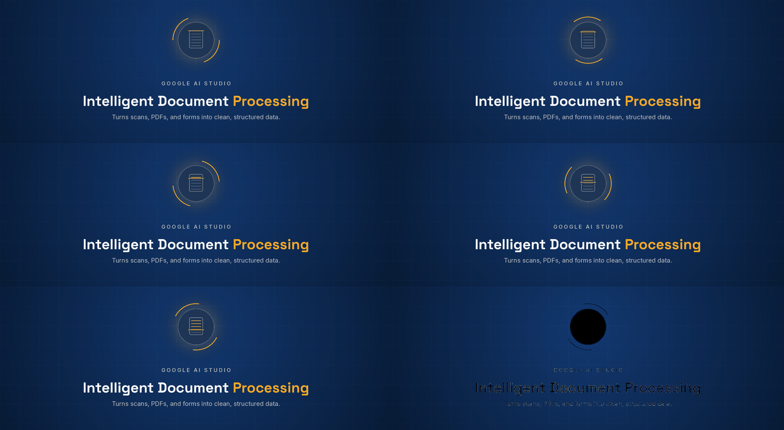
Extract data from any unstructured document — invoices, contracts, medical records, application forms, or scanned PDFs — with over 90% accuracy. AI reads and understands document content regardless of format variations, template changes, or handwritten annotations, outputting structured data ready for workflow processing.
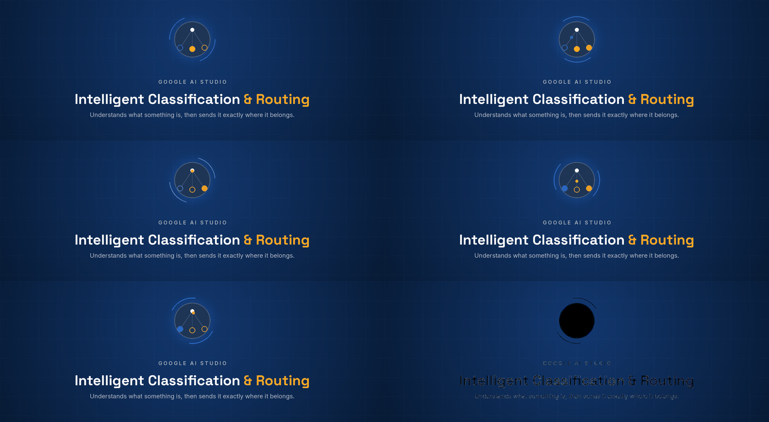
AI classifies incoming requests, documents, or data records by intent, urgency, category, and required action — routing them to the correct workflow path automatically. An invoice goes to accounts payable. A complaint goes to customer service. A high-priority escalation goes directly to a manager. No manual triage required.

Google AI Studio supports agentic AI — AI systems that can execute multi-step tasks autonomously. An AI agent can read an email, check a database, make a decision, draft a response, and trigger a workflow action — all without human intervention. This is the foundation of truly end-to-end intelligent automation.

SOLUTION OVERVIEW

Geo-Analytics, Network Mapping & Business Intelligence Powered by Lepton

iAmaze delivers Lepton’s full suite of Location Intelligence and GIS solutions, configured for your industry and integrated with your existing data systems. From network planning and asset tracking to market expansion analytics and real-time geo-dashboards, we provide a complete geospatial intelligence layer for your organisation.

Smart Planner

Fiber & FTTx Network Planning End-to-End

Smart Market

Location Intelligence Market Expansion Site Selection

new360

Geo-Analytics Telecom Insights KPI Dashboards

rFMAP

2D/3D RF Mapping Wireless Planning Smart City

Smart Signal

Digital Twin Network Analytics Optimization

Lepton Maps API

Mapping Platform Advanced Analytics Enterprise Ready

SmartData

Geospatial Datasets Data as a Service Spatial Insights

SmartOps

Workforce Mgmt Field Operations Efficiency

The Lepton Platform — Delivered by iAmaze

NetworkAccess — Telecom Network Intelligence

Lepton's flagship telecom platform integrating SmartPlanner (fiber/FTTx network planning), SmartInventory (network asset management), SmartOps (workforce management), SmartSQ (service feasibility), and SmartSignal (digital twin creation). End-to-end visibility and optimisation for telecom operators.

SmartMarket — Location Intelligence for Business Growth

AI-powered geospatial analytics platform that combines demographic data, mobility patterns, competitor mapping, and behavioral insights. Enables enterprises to identify high-demand zones, optimise site selection, forecast revenue, and build data-driven market expansion strategies.

neo360 — Geo-Analytics for Telecom & Enterprise

Purpose-built geo-analytics tool that transforms telecom and enterprise data into actionable KPI dashboards. Eliminates data silos, identifies critical user patterns, analyses competitor behaviour, and provides department-wise analytics for accurate decision-making across your organisation.

rfMAP — RF & Wireless Network Mapping

Advanced 2D and 3D mapping solution for wireless network planning, RF coverage analysis, risk mitigation, and smart city development. Enables telecom operators to plan deployments, assess interference, and optimise coverage using precision spatial modelling.

Lepton Maps API — Mapping for Your Applications

Enterprise-grade mapping APIs that enhance your own applications with advanced location analytics, route optimisation, geocoding, and spatial search capabilities. Google Maps Premium Partner integration delivers the world’s most accurate mapping data.

SmartData — Geospatial Data as a Service

High-accuracy, India-specific and global geospatial datasets covering demographics, mobility patterns, points of interest, administrative boundaries, and infrastructure. Available as a subscription service or on-demand dataset to power your analytics and decision models.

KEY FEATURES

Location Intelligence Capabilities That Drive Business Results

GIS Mapping & Spatial Analytics

Interactive, multi-layer GIS maps that integrate your business data with geographic context. Drill down from national to pin-code level. Overlay competitor data, infrastructure maps, demographic layers, and real-time telemetry for complete spatial intelligence.

Location-Based Data Visualisation

Heatmaps, choropleth maps, territory maps, network topology visualisations, and custom dashboards that make geographic patterns instantly visible. Built-in support for satellite imagery, street maps, and 3D spatial views.

Network & Asset Intelligence

Complete visibility into your physical infrastructure — telecom towers, fiber routes, service zones, field assets, and workforce positions — mapped, monitored, and managed through a unified geospatial platform.

Market Expansion & Site Intelligence

Pin-code level demographic insights, footfall data, competitor proximity mapping, affluence scoring, and market whitespace analysis to support high-confidence expansion decisions for retail, BFSI, telecom, and FMCG sectors.

Real-Time Tracking & Geo-Dashboards

Live tracking of field teams, delivery fleets, and mobile assets overlaid on GIS maps. Real-time KPI dashboards with geographic breakdowns enable operational managers to monitor performance as it happens across regions.

Compliance & Standards Reporting

Regulatory reporting with spatial context — coverage maps, service area declarations, infrastructure audits, and planning submissions supported with GIS-validated evidence for government and regulatory compliance.

BUSINESS BENEFITS

What Location Intelligence Delivers for Your Organisation

Faster, Data-Driven Decisions

Replace intuition-based decisions with geo-validated intelligence. Location data eliminates ambiguity from site selection, network investment, market expansion, and logistics planning — reducing decision cycles from weeks to hours.

Cost Optimisation & Operational Efficiency

Identify route inefficiencies, network redundancies, underperforming territories, and resource allocation gaps using spatial analytics. Our clients report significant cost savings in network rollout, field operations, and market expansion.

Improved Planning & Accurate Forecasting

Model future scenarios using historical spatial trends and demographic data. Whether forecasting network demand, projecting store performance, or planning infrastructure expansion, geo-intelligence improves forecast accuracy dramatically.

Competitive Business Advantage

See where competitors operate, where market whitespace exists, and where your customers are clustering — before your competitors do. Location intelligence turns geographic insight into first-mover advantage.

Regulatory & Compliance Readiness

Spatial evidence for regulatory submissions, coverage declarations, planning applications, and infrastructure audits. GIS-validated reports strengthen compliance positions with government and regulatory authorities.

Single Source of Spatial Truth

Eliminate data silos by unifying your operational data, customer data, and infrastructure data in a single geospatial platform. Every team — from field operations to executive leadership — works from the same location-aware view.

USE CASES

Industry Applications Across Every Sector

Telecom — Network Planning & Optimisation

Plan fiber and FTTx rollouts with SmartPlanner, model RF coverage with rfMAP, manage network inventory with SmartInventory, and create digital twins with SmartSignal. Lepton’s telecom suite is deployed by leading operators across India, the Middle East, and Africa.

Logistics — Route & Distribution Intelligence

Overlay customer density maps, traffic patterns, and delivery zone data to design optimal logistics networks. Identify high-cost routes, underserved territories, and distribution centre location opportunities using geo-analytics.

Retail & FMCG — Site Selection & Market Expansion

SmartMarket delivers pin-code level demographic insights, footfall data, competitor proximity mapping, and market whitespace analysis. Retailers and FMCG companies use it to make high-confidence expansion decisions and optimise sales territory design.

BFSI — Branch Network Planning & Risk Mapping

Map customer concentration zones, competitor branch locations, demographic affluence, and credit risk geographies to plan branch expansion, ATM deployment, and microfinance penetration strategies.

Government & Smart City

Municipal and government agencies use Lepton’s GIS to plan urban infrastructure, manage utility networks, design emergency response zones, track public asset maintenance, and build data-driven city masterplans.

Automobile — Dealer & Service Network Planning

Analyse population density, vehicle registration data, competitor dealership locations, and service coverage maps to optimise dealer network expansion and service centre placement for maximum market penetration.

WHY iAMAZE + LEPTON

The Partnership Built for Enterprise GIS Success

Choosing a GIS and Location Intelligence partner is a strategic decision. Here is why enterprises across India and the region choose the iAmaze + Lepton combination:

Proven GIS Platform — 30 Years of Lepton

Lepton Software has been at the forefront of geospatial intelligence since 1994. From India’s first major telecom GIS deployments to cutting-edge AI-driven location analytics, Lepton’s platform is built on three decades of domain expertise and real-world enterprise deployments.

Expert Implementation — iAmaze Delivery

iAmaze brings deep implementation expertise across all Lepton modules. Our certified team handles everything from requirements analysis and platform configuration to data migration, system integration, user training, and ongoing managed support.

Google Maps Premium Partner

Lepton Software is a distinguished Google Maps Platform Premium Partner, giving our clients access to the world’s most accurate, up-to-date mapping data combined with Lepton’s advanced geospatial analytics layer.

Scalable, Enterprise-Ready Architecture

Lepton’s platform scales from single-city deployments to national and multi-country enterprise rollouts. Modular architecture means you can start with one solution and expand across the full suite as your needs grow.

India-Focused, Globally Proven

Deep knowledge of India’s geographic, demographic, and regulatory landscape combined with global deployment experience across 37+ countries. iAmaze adds local consulting depth to Lepton’s world-class global platform.

24/7 Support & Continuous Innovation

Lepton’s global support and iAmaze’s local managed services team provide round-the-clock support. Regular platform updates, new data layers, and AI-driven analytics enhancements keep your GIS investment continuously current.

HOW WE WORK

Your GIS Journey — Four Steps from Insight to Outcome

Every iAmaze + Lepton engagement follows a structured delivery framework that ensures fast time-to-value, minimal disruption, and maximum adoption across your organisation.

Consult & Assess

iAmaze evaluates your business goals, data landscape, and industry requirements to design the right Lepton solution for your needs.

Configure & Deploy

We implement and customize the chosen Lepton platform - from SmartPlanner for telecom to SmartMarket for retail - tailored to your workflows.

Integrate & Train

We integrate with your existing systems, migrate your data, and deliver comprehensive training for your teams across all modules.

Optimize & Scale

Ongoing managed support, quarterly reviews, and platform evolution ensure your GIS investment grows with your business.

FAQs

Common Questions About Location Intelligence

The Lepton platform is deployed across telecom, retail, FMCG, logistics, BFSI, automobile, government, and smart city sectors. iAmaze configures the appropriate Lepton modules for each industry context, ensuring your solution is precisely aligned with your specific use case.

Implementation timelines vary by solution complexity. SmartMarket deployments for market expansion analytics typically take 4-6 weeks. Telecom NetworkAccess implementations range from 8-16 weeks depending on network scale and integration requirements. iAmaze provides a detailed project plan at the start of every engagement.

Yes. Lepton’s platform provides RESTful APIs and standard data connectors for integration with ERP, CRM, BI tools, and telecom OSS/BSS systems. iAmaze’s integration team handles the technical implementation of all connections to your existing data infrastructure.

Location Intelligence works with any data that has a geographic component: customer addresses, asset locations, delivery routes, network infrastructure coordinates, market boundaries, demographic datasets, and real-time location telemetry. iAmaze can also help source third-party geospatial data layers through Lepton’s SmartData service.

No. Lepton’s platforms are designed for business users, not GIS specialists. SmartMarket, neo360, and NetworkAccess feature intuitive dashboards that require no GIS background. iAmaze provides training, onboarding, and ongoing managed support to ensure your teams are productive from day one.

THE SOLUTION

AI + Automation — Intelligence That Acts, Execution That Scales

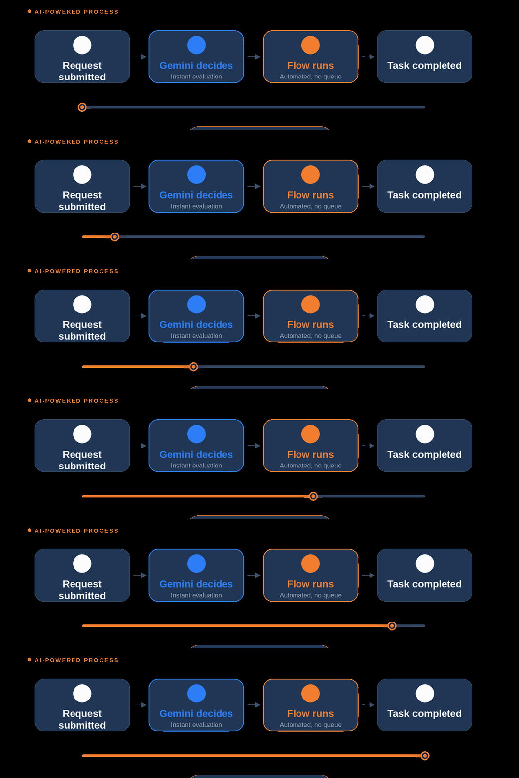
iAmaze combines Google AI Studio’s Gemini-powered intelligence with Microsoft Power Automate’s enterprise workflow engine to build automation that is genuinely smart. Not just rule-following. Google AI Studio provides the reasoning layer: understanding documents, classifying intent, generating responses, and making nuanced decisions. Power Automate provides the execution layer: triggering actions, updating systems, routing approvals, and connecting every application your business runs on.

The difference between rule-based automation and AI-powered automation is the difference between a script that breaks on edge cases and a system that thinks. When AI decides and automation executes, you get workflows that handle real-world business complexity — not just the simple cases that work in a demo.